Florida Department of Transportation
Florida Statewide and Regional ITS Architectures

Florida ITS Architecture Banner
 

SU04: Map Management (County and Local SPaT Project) Diagrams

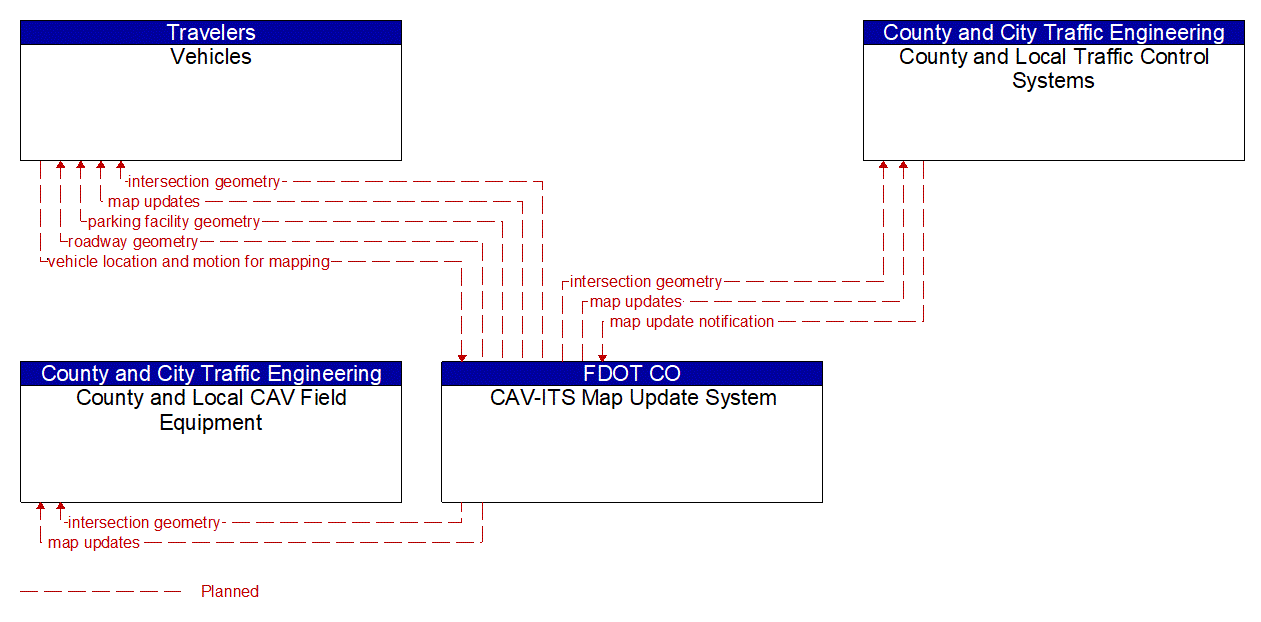
There are two diagrams below that represent this service package. The first is an interconnect diagram that just shows what elements are connected to each other. The second is an information flow diagram that shows the information flowing between the connected elements.
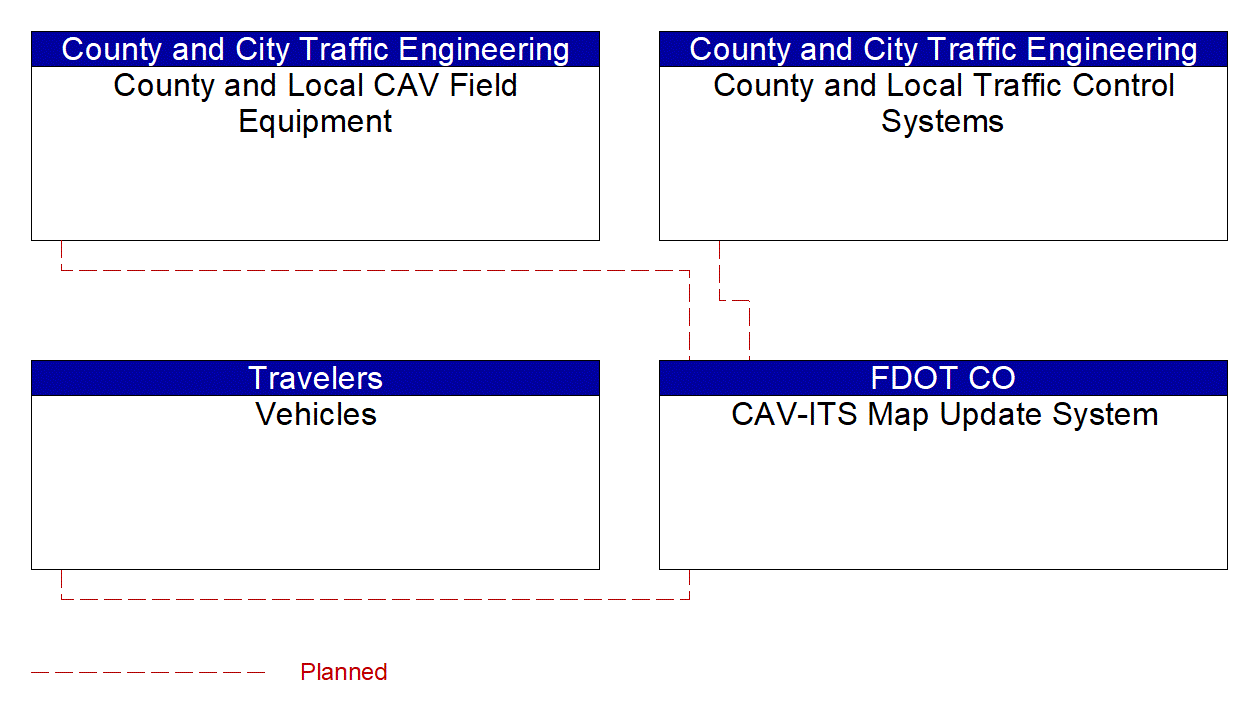
SU04: Map Management (County and Local SPaT Project) Interconnect Diagram

Service Graphic: Map Management (County and Local SPaT Project)

SU04: Map Management (County and Local SPaT Project) Information Flow Diagram

Service Graphic: Map Management (County and Local SPaT Project)

Last Updated 1/21/2025