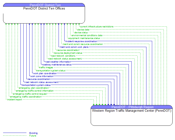
Interface: PennDOT District Ten Offices - Western Region Traffic Management Center (PennDOT)
Information Flow Definitions
current infrastructure restrictions (Future) Selected Comm Solution
Restrictions levied on transportation asset usage based on infrastructure design, surveys, tests, or analyses. This includes standard facility design height, width, and weight restrictions, special restrictions such as spring weight restrictions, and temporary facility restrictions that are imposed during maintenance and construction.
device data (Future) Selected Comm Solution
Data from detectors, environmental sensor stations, roadside equipment, and traffic control devices, including device inventory information.
device status (Future) Selected Comm Solution
Status information from devices
emergency plan coordination (Future) Selected Comm Solution
Information that supports coordination of emergency management plans, continuity of operations plans, emergency response and recovery plans, evacuation plans, and other emergency plans between agencies. This includes general plans that are coordinated prior to an incident and shorter duration tactical plans that are prepared during an incident.
emergency traffic control information (Future) Selected Comm Solution
Status of a special traffic control strategy or system activation implemented in response to an emergency traffic control request, a request for emergency access routes, a request for evacuation, a request to activate closure systems, a request to employ driver information systems to support public safety objectives, or other special requests. Identifies the selected traffic control strategy and system control status.
emergency traffic control request (Future) Selected Comm Solution
Special request to preempt the current traffic control strategy in effect at one or more signalized intersections or highway segments, activate traffic control and closure systems such as gates and barriers, activate safeguard systems, or use driver information systems. For example, this flow can request all signals to red–flash, request a progression of traffic control preemptions along an emergency vehicle route, request a specific evacuation traffic control plan, request activation of a road closure barrier system, or place a public safety or emergency–related message on a dynamic message sign.
emergency traffic coordination (Future) Selected Comm Solution
Coordination supporting disaster response including evacuation and reentry. Includes coordination of special traffic control strategies that support efficient evacuation and reentry while protecting and optimizing movement of response vehicles and other resources responding to the emergency.
environmental conditions data (Future) Selected Comm Solution
Current road conditions (e.g., surface temperature, subsurface temperature, moisture, icing, treatment status) and surface weather conditions (e.g., air temperature, wind speed, precipitation, visibility) as measured and reported by fixed and/or mobile environmental sensors and aggregated by the data collector. Attributes relating to the data collection (and aggregation) are also included.
equipment maintenance status (Future) Selected Comm Solution
Current status of field equipment maintenance actions.
incident report (Future)
Report of an identified incident including incident location, type, severity and other information necessary to initiate an appropriate incident response.
incident response coordination (Existing)
Incident response procedures and current incident response status that are shared between allied response agencies to support a coordinated response to incidents. This flow provides current situation information, including a summary of incident status and its impact on the transportation system and other infrastructure, and current and planned response activities. This flow also coordinates a positive hand off of responsibility for all or part of an incident response between agencies.
maint and constr resource coordination (Future) Selected Comm Solution
Request for road maintenance and construction resources that can be used in the diversion of traffic (cones, portable signs), clearance of a road hazard, repair of ancillary damage, or any other incident response.
maint and constr work plans (Existing) Selected Comm Solution
Future construction and maintenance work schedules and activities including anticipated closures with anticipated impact to the roadway, alternate routes, anticipated delays, closure times, and durations.
resource coordination (Existing)
Coordination of resource inventory information, specific resource status information, resource prioritization and reallocation between jurisdictions, and specific requests for resources and responses that service those requests.
resource deployment status (Future) Selected Comm Solution
Status of resource deployment identifying the resources (vehicles, equipment, materials, and personnel) available and their current status. General resource inventory information and specific status of deployed resources may be included.
road network conditions (Future) Selected Comm Solution
Current and forecasted traffic information, road and weather conditions, and other road network status. Either raw data, processed data, or some combination of both may be provided by this flow. Information on diversions and alternate routes, closures, and special traffic restrictions (lane/shoulder use, weight restrictions, width restrictions, HOV requirements) in effect is included.
road network status assessment (Future) Selected Comm Solution
Assessment of damage sustained by the road network including location and extent of the damage, estimate of remaining capacity, required closures, alternate routes, necessary restrictions, and time frame for repair and recovery.
road weather information (Existing) Selected Comm Solution
Road conditions and weather information that are made available by road maintenance operations to other transportation system operators.
roadway maintenance status (Existing) Selected Comm Solution
Summary of maintenance fleet operations affecting the road network. This includes the status of winter maintenance (snow plow schedule and current status).
traffic images (Future)
High fidelity, real–time traffic images suitable for surveillance monitoring by the operator or for use in machine vision applications. This flow includes the images. Meta data that describes the images is contained in another flow.
transportation system status (Existing) Selected Comm Solution
Current status and condition of transportation infrastructure (e.g., tunnels, bridges, interchanges, TMC offices, maintenance facilities). In case of disaster or major incident, this flow provides an assessment of damage sustained by the surface transportation system including location and extent of the damage, estimate of remaining capacity and necessary restrictions, and time frame for repair and recovery.
work plan coordination (Existing) Selected Comm Solution
Coordination of work plan schedules and activities between maintenance and construction organizations or systems. This information includes the work plan schedules and comments and suggested changes that are exchanged as work plans are coordinated and finalized.
work zone information (Existing) Selected Comm Solution
Summary of maintenance and construction work zone activities affecting the road network including the nature of the maintenance or construction activity, location, impact to the roadway, expected time(s) and duration of impact, anticipated delays, alternate routes, and suggested speed limits. This information may be augmented with images that provide a visual indication of current work zone status and traffic impacts.