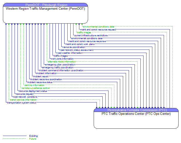
Interface: Western Region Traffic Management Center (PennDOT) - PTC Traffic Operations Center (PTC Ops Center)
Information Flow Definitions
alternate mode information (Future) Selected Comm Solution
Schedule information for alternate mode transportation providers such as air, ferry, and passenger–carrying heavy rail. This also includes details of incidents and other service disruptions that have occurred in the alternative mode. This also includes measures of service demand that supports assessment of their impact on the road network.
current infrastructure restrictions (Existing) Selected Comm Solution
Restrictions levied on transportation asset usage based on infrastructure design, surveys, tests, or analyses. This includes standard facility design height, width, and weight restrictions, special restrictions such as spring weight restrictions, and temporary facility restrictions that are imposed during maintenance and construction.
emergency plan coordination (Existing) Selected Comm Solution
Information that supports coordination of emergency management plans, continuity of operations plans, emergency response and recovery plans, evacuation plans, and other emergency plans between agencies. This includes general plans that are coordinated prior to an incident and shorter duration tactical plans that are prepared during an incident.
emergency traffic coordination (Existing) Selected Comm Solution
Coordination supporting disaster response including evacuation and reentry. Includes coordination of special traffic control strategies that support efficient evacuation and reentry while protecting and optimizing movement of response vehicles and other resources responding to the emergency.
environmental conditions data (Future) Selected Comm Solution
Current road conditions (e.g., surface temperature, subsurface temperature, moisture, icing, treatment status) and surface weather conditions (e.g., air temperature, wind speed, precipitation, visibility) as measured and reported by fixed and/or mobile environmental sensors and aggregated by the data collector. Attributes relating to the data collection (and aggregation) are also included.
incident command information coordination (Existing)
Information that supports local management of an incident. It includes resource deployment status, hazardous material information, traffic, road, and weather conditions, evacuation advice, and other information that enables emergency or maintenance personnel in the field to implement an effective, safe incident response.
incident information (Existing) Selected Comm Solution
Notification of existence of incident and expected severity, location, time and nature of incident. As additional information is gathered and the incident evolves, updated incident information is provided. Incidents include any event that impacts transportation system operation ranging from routine incidents (e.g., disabled vehicle at the side of the road) through large–scale natural or human–caused disasters that involve loss of life, injuries, extensive property damage, and multi–jurisdictional response. This also includes special events, closures, and other planned events that may impact the transportation system.
incident report (Existing)
Report of an identified incident including incident location, type, severity and other information necessary to initiate an appropriate incident response.
incident response coordination (Existing)
Incident response procedures and current incident response status that are shared between allied response agencies to support a coordinated response to incidents. This flow provides current situation information, including a summary of incident status and its impact on the transportation system and other infrastructure, and current and planned response activities. This flow also coordinates a positive hand off of responsibility for all or part of an incident response between agencies.
incident response status (Existing) Selected Comm Solution
Status of the current incident response including a summary of incident status and its impact on the transportation system, traffic management strategies implemented at the site (e.g., closures, diversions, traffic signal control overrides), and current and planned response activities.
maint and constr resource request (Existing) Selected Comm Solution
Request for road maintenance and construction resources that can be used in the diversion of traffic (cones, portable signs), clearance of a road hazard, repair of ancillary damage, or any other incident response. The request may poll for resource availability or request pre–staging, staging, or immediate dispatch of resources.
maint and constr resource response (Existing) Selected Comm Solution
Current status of maintenance and construction resources including availability and deployment status. General resource inventory information covering vehicles, equipment, materials, and people and specific resource deployment status may be included.
maint and constr work plans (Existing) Selected Comm Solution
Future construction and maintenance work schedules and activities including anticipated closures with anticipated impact to the roadway, alternate routes, anticipated delays, closure times, and durations.
parking information (Future) Selected Comm Solution
General parking information and status, including current parking availability, parking pricing, and parking space availability information.
remote surveillance control (Existing) Selected Comm Solution
The control commands used to remotely operate another center's sensors or surveillance equipment so that roadside surveillance assets can be shared by more than one agency.
resource coordination (Existing)
Coordination of resource inventory information, specific resource status information, resource prioritization and reallocation between jurisdictions, and specific requests for resources and responses that service those requests.
resource deployment status (Existing) Selected Comm Solution
Status of resource deployment identifying the resources (vehicles, equipment, materials, and personnel) available and their current status. General resource inventory information and specific status of deployed resources may be included.
resource request (Existing) Selected Comm Solution
A request for resources to implement special traffic control measures, assist in clean up, verify an incident, etc. The request may poll for resource availability or request pre–staging, staging, or immediate deployment of resources. Resources may be explicitly requested or a service may be requested and the specific resource deployment may be determined by the responding agency.
road network conditions (Existing) Selected Comm Solution
Current and forecasted traffic information, road and weather conditions, and other road network status. Either raw data, processed data, or some combination of both may be provided by this flow. Information on diversions and alternate routes, closures, and special traffic restrictions (lane/shoulder use, weight restrictions, width restrictions, HOV requirements) in effect is included.
road network status assessment (Existing) Selected Comm Solution
Assessment of damage sustained by the road network including location and extent of the damage, estimate of remaining capacity, required closures, alternate routes, necessary restrictions, and time frame for repair and recovery.
road weather information (Existing) Selected Comm Solution
Road conditions and weather information that are made available by road maintenance operations to other transportation system operators.
traffic images (Future)
High fidelity, real–time traffic images suitable for surveillance monitoring by the operator or for use in machine vision applications. This flow includes the images. Meta data that describes the images is contained in another flow.
transit service information (Future) Selected Comm Solution
Transit service information including routes, schedules, and fare information as well as dynamic transit schedule adherence and transit vehicle location information.
transportation system status (Existing) Selected Comm Solution
Current status and condition of transportation infrastructure (e.g., tunnels, bridges, interchanges, TMC offices, maintenance facilities). In case of disaster or major incident, this flow provides an assessment of damage sustained by the surface transportation system including location and extent of the damage, estimate of remaining capacity and necessary restrictions, and time frame for repair and recovery.
work zone information (Existing) Selected Comm Solution
Summary of maintenance and construction work zone activities affecting the road network including the nature of the maintenance or construction activity, location, impact to the roadway, expected time(s) and duration of impact, anticipated delays, alternate routes, and suggested speed limits. This information may be augmented with images that provide a visual indication of current work zone status and traffic impacts.