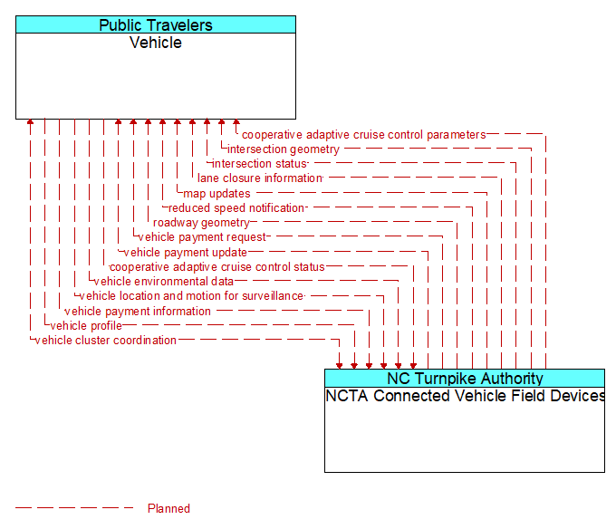
Interface: Vehicle - NCTA Connected Vehicle Field Devices
Architecture Flow Definitions
cooperative adaptive cruise control parameters (Planned) Applicable ITS Standards
Information, instructions, and control parameters for CACC operations including current system conditions and advisories, control parameters (e.g., target speeds, required vehicle profiles, recommended gaps, lane information) and cluster instructions that support CACC vehicle string creation and dissolution.
cooperative adaptive cruise control status (Planned) Applicable ITS Standards
Data provided by a connected vehicle identifying it's current mode and operational status and information provided to support CACC string creation and dissolution.
intersection geometry (Planned) Applicable ITS Standards
The physical geometry of an intersection covering the location and width of each approaching lane, egress lane, and valid paths between approaches and egresses. This flow also defines the location of stop lines, cross walks, specific traffic law restrictions for the intersection (e.g., turning movement restrictions), and other elements that support calculation of a safe and legal vehicle path through the intersection.
intersection status (Planned) Applicable ITS Standards
Current signal phase and timing information for all lanes at a signalized intersection. This flow identifies active lanes and lanes that are being stopped and specifies the length of time that the current state will persist for each lane. It also identifies signal priority and preemption status and pedestrian crossing status information where applicable.
lane closure information (Planned) Applicable ITS Standards
Lane closure information provided to passing vehicles. This flow provides information about roadway configuration changes such as lane closures and shifts.
map updates (Planned) Applicable ITS Standards
Map update which could include a new underlying static or real–time map or map layer(s) update.
reduced speed notification (Planned) Applicable ITS Standards
Reduced speed zone information provided to passing vehicles. This flow provides the reduced speed limit, the location and extent of the reduced speed zone, and associated warning information.
roadway geometry (Planned) Applicable ITS Standards
The physical geometry of a road segment that specifies the location and width of each lane, including normal lanes as well as special lanes for pedestrians and bicycles, transit vehicles, and trains. This flow also may include the curvature, grade, and superelevation or banking of the road segment.
vehicle cluster coordination (Planned) Applicable ITS Standards
Coordination between CACC–equipped vehicles that enable formation and management of strings of adjacent equipped vehicles that coordinate speed management across the string. This flow includes coordination between CACC–equipped vehicles that enable adjacent vehicles in the same lane to identify each other and couple. Depending on the CACC implementation, this flow also supports identification of the lead vehicle in the string, operating performance parameters for the string, destination information so that drivers can join strings that share their destination, and coordination so that strings of vehicles are ordered based on the individual weight and performance profile of each participating vehicle. This flow also supports dissolution of CACC vehicle strings as vehicles depart from the string.
vehicle environmental data (Planned) Applicable ITS Standards
Data from vehicle safety and convenience systems that can be used to estimate environmental and infrastructure conditions, including measured air temperature, exterior light status, wiper status, sun sensor status, rain sensor status, traction control status, anti–lock brake status, vertical acceleration and other collected vehicle system status and sensor information. The collected data is reported along with the location, heading, and time that the data was collected. Both current data and snapshots of recent events (e.g., traction control or anti–lock brake system activations) may be reported.
vehicle location and motion for surveillance (Planned) Applicable ITS Standards
Data describing the vehicle's position, heading, speed, acceleration, transmission, steering wheel angle, braking status, size information, and trajectory. This flow represents monitoring of basic safety data ('vehicle location and motion') broadcast by passing connected vehicles for use in vehicle detection and traffic monitoring applications.
vehicle payment information (Planned) Applicable ITS Standards
Information provided for payment of tolls, parking, and other transportation fees including identification that can be used to identify the payment account or source and related vehicle and service information that are used to determine the type and price of service requested. The information exchange normally supports an account debit to pay fees, but an account credit may be initiated where pricing strategies include incentives.
vehicle payment request (Planned) Applicable ITS Standards
Request for information supporting payments. For fee structures that include incentives, the request may support either an account debit or an account credit or reimbursement.
vehicle payment update (Planned) Applicable ITS Standards
Data written to vehicle equipment to support electronic toll collection or parking payment.
vehicle profile (Planned) Applicable ITS Standards
Information about a vehicle such as vehicle make and model, fuel type, engine type, size and weight, vehicle performance and level of control automation, average emissions, average fuel consumption, passenger occupancy, or other data that can be used to classify vehicle eligibility for access to specific lanes, road segments, or regions or participation in cooperative vehicle control applications.